Home > Arts > Photorealistic artworks > Detailed art pieces > Masterful detailing in art
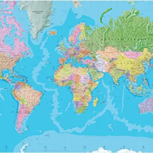
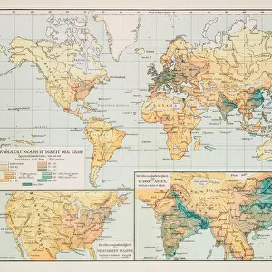
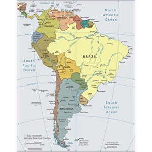
North America Physical Map, Engraving, 1892

![]()
Wall Art and Photo Gifts from Fine Art Storehouse
North America Physical Map, Engraving, 1892
Very rare, beautifully detailed engraving of North America Physical Map, Engraving, Published in 1892. Original edition from my own archives. Copyright has expired on this artwork. Digitally restored
Unleash your creativity and transform your space into a visual masterpiece!
bauhaus1000
Media ID 13609139
© This content is subject to copyright
18th Century Art Product Canada Chart Colors Country Geographic Area Cuba Geographical Border Graph Greenland Land Mexico North America The Americas Topography View Into Land Multi Colored
FEATURES IN THESE COLLECTIONS
> Animals
> Mammals
> Muridae
> Water Mouse
> Arts
> Photorealistic artworks
> Detailed art pieces
> Masterful detailing in art
> Arts
> Street art graffiti
> Digital art
> Digital paintings
> Europe
> France
> Canton
> Landes
> Fine Art Storehouse
> Map
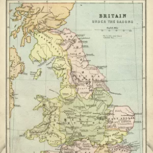
> Historical Maps
> Fine Art Storehouse
> Map
> USA Maps
> Maps and Charts
> Related Images
> North America
> Canada
> Maps
> North America
> Canada
> Related Images
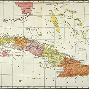
> North America
> Cuba
> Maps
> North America
> Cuba
> Related Images
EDITORS COMMENTS
This stunning print showcases a very rare and exquisitely detailed engraving of the North America Physical Map, published in 1892. As an original edition from the personal archives of bauhaus1000, this artwork holds immense historical value. With its copyright expired, this digitally restored piece allows us to appreciate the intricate craftsmanship and artistry of the past. The vertical composition captures the vastness of North America's geographic area, featuring prominent countries such as Cuba, Mexico, Canada, USA, and Greenland. The enchanting blend of colors brings out the topography of land and water with remarkable precision. This 19th-century style engraving evokes a sense of nostalgia while offering valuable insights into our continent's physical geography. As we delve into this archival illustration, we are transported back in time to an era when cartography was both a science and an art form. The geographical borders are meticulously delineated on this old antique map that serves as a testament to human curiosity about our world. Whether you are an avid collector or simply captivated by history and geography, this art product is sure to be a cherished addition to any space. Let yourself be enchanted by the beauty captured within these lines etched onto paper over a century ago - it is truly a masterpiece worth treasuring for generations to come.
MADE IN THE USA
Safe Shipping with 30 Day Money Back Guarantee
FREE PERSONALISATION*
We are proud to offer a range of customisation features including Personalised Captions, Color Filters and Picture Zoom Tools
SECURE PAYMENTS
We happily accept a wide range of payment options so you can pay for the things you need in the way that is most convenient for you
* Options may vary by product and licensing agreement. Zoomed Pictures can be adjusted in the Cart.