Home > Europe > United Kingdom > England > London > Boroughs > Hillingdon
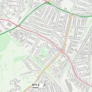
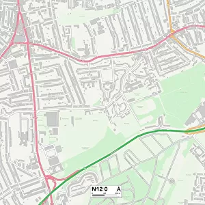
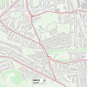
Hillingdon HA6 2 Map

![]()
Wall Art and Photo Gifts from Map Marketing
Hillingdon HA6 2 Map
Postcode Sector Map of Hillingdon HA6 2
Media ID 19970565
A404 Bedford Road Chelwood Close College Way Copse Close Cygnet Close Dene Road East Drive Falcon Close Farm Road Grove Road Harrison Close Highfield Close Highfield Crescent Hill Road Hillingdon Hills Lane Iveagh Close Kingfisher Close Lakeside Close Lingfield Close Links Way Linksway Main Avenue Mallard Way Manor House Drive Maxwell Road Moor Park Murray Road Northgate Ormonde Road Oxford Close Pembroke Road Rickmansworth Road Russell Close Russell Road Sandy Lane Silverwood Close St Martins Teal Drive The Avenue The Covert The Dell The Glen Thirlmere Gardens Thornhill Road Treetops Close Trinity Close Wedgewood Close Westbury Road Westminster Close White Hill Wolsey Road Woodlea Grove Wildwood
FEATURES IN THESE COLLECTIONS
> Animals
> Birds
> Charadriiformes
> Sandpipers
> Ruff
> Animals
> Birds
> Coraciiformes
> Kingfishers
> Related Images
> Animals
> Birds
> Waterfowl
> Ducks
> Mallard
> Animals
> Mammals
> Dogs (Wild)
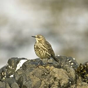
> Anthus
> Animals
> Mammals
> Muridae
> Heath Mouse
> Europe
> United Kingdom
> England
> London
> Boroughs
> Hillingdon
> Europe
> United Kingdom
> Scotland
> Dumfries and Galloway
> Thornhill
> Europe
> United Kingdom
> Scotland
> Moray
> Elgin
> Europe
> United Kingdom
> Wales
> Pembrokeshire
> Pembroke
> Map Marketing
> Postcode Sector Maps
> HA - Harrow
> Maps and Charts
> Related Images
MADE IN THE USA
Safe Shipping with 30 Day Money Back Guarantee
FREE PERSONALISATION*
We are proud to offer a range of customisation features including Personalised Captions, Color Filters and Picture Zoom Tools
SECURE PAYMENTS
We happily accept a wide range of payment options so you can pay for the things you need in the way that is most convenient for you
* Options may vary by product and licensing agreement. Zoomed Pictures can be adjusted in the Cart.