Home > Europe > United Kingdom > Northern Ireland > Railways
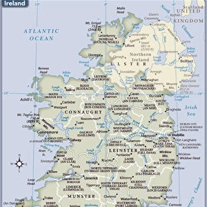
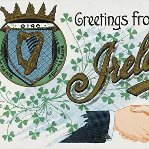
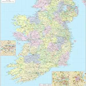
Ireland Political Road Map

![]()
Wall Art and Photo Gifts from Map Marketing
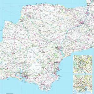
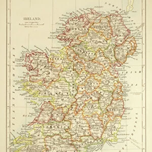
Ireland Political Road Map
A detailed road map of the island of Ireland colour coded by county/district. The detailed map base consists of a comprehensive road network and all main towns as a backdrop with each county shaded in a different colour for ease of identification. In Ulster the county boundaries are marked and named to include the county changes that came into effect in April 2015. Major railway lines, ferry routes and rivers are also shown. City centre street insets are included for Dublin, Belfast and Cork. Information concerning physical features, population, surface area and currency is shown in an inset box
Media ID 19949310
© Map Marketing Ltd 2019, Map derived from Collins Bartholomew Digital Data Collins Bartholomew Ltd 2020
Belfast Cork Counties Dublin Eire Motorways Northern Ireland
FEATURES IN THESE COLLECTIONS
> Arts
> Contemporary art
> Digital artwork
> Street art
> Arts
> Photorealistic artworks
> Detailed art pieces
> Masterful detailing in art
> Europe
> Republic of Ireland
> Cork
> Europe
> Republic of Ireland
> Dublin
> Europe
> Republic of Ireland
> Maps
> Europe
> United Kingdom
> Northern Ireland
> Belfast
> Europe
> United Kingdom
> Northern Ireland
> Maps
> Europe
> United Kingdom
> Northern Ireland
> Politics
> Europe
> United Kingdom
> Northern Ireland
> Posters
> Europe
> United Kingdom
> Northern Ireland
> Railways
MADE IN THE USA
Safe Shipping with 30 Day Money Back Guarantee
FREE PERSONALISATION*
We are proud to offer a range of customisation features including Personalised Captions, Color Filters and Picture Zoom Tools
SECURE PAYMENTS
We happily accept a wide range of payment options so you can pay for the things you need in the way that is most convenient for you
* Options may vary by product and licensing agreement. Zoomed Pictures can be adjusted in the Cart.