Home > Europe > United Kingdom > Scotland > Dance
Large map siege Namur first text sheet 1695 Plan de la Ville

![]()
Wall Art and Photo Gifts from Liszt Collection
Large map siege Namur first text sheet 1695 Plan de la Ville
Large map of the siege of Namur (first text sheet), 1695 Plan de la Ville and the Chateau de Namur, dance l etat qu etoit cette Place lors qu elle fut assee et reprise and 1695 par les Armes des Alliez, sous la tres sage et tres valleuse conductor du Roi de la Grande Bretagne (title on object), Text sheet with the large unassembled map of the siege van Namen by the allies under King Willem III during the months of July-September 1695. The map is made up of four separate numbered representations and two sheets with the caption. Text sheet with the first part of the legend. Namur, Willem III (Prince of Orange and King of England, Scotland and Ireland), Nicolaes Visscher (II), Amsterdam, 1695, paper, letterpress printing, h 138 mm × w 635 mm
Liszt Collection of nineteenth-century engravings and images to browse and enjoy
Media ID 19544882
© Artokoloro
1695 Caption First Part Ireland King Legend Letterpress Printing Months Namur Nicolaes Visscher Orange Prince Siege Text Sheet Title Two Sheets Willem Iii
FEATURES IN THESE COLLECTIONS
> Europe
> France
> Canton
> Allier
> Europe
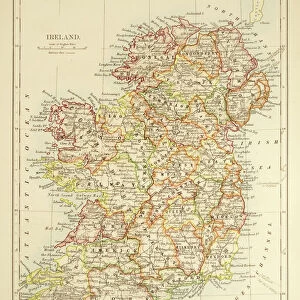
> Republic of Ireland
> Maps
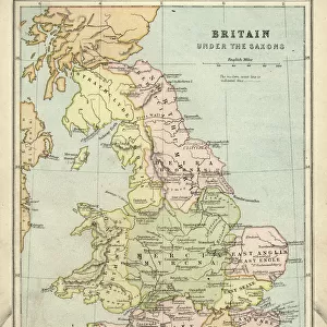
> Europe
> United Kingdom
> England
> Dance
> Europe
> United Kingdom
> England
> Maps
> Europe
> United Kingdom
> Scotland
> Dance
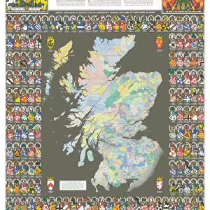
> Europe
> United Kingdom
> Scotland
> Maps
> Europe
> United Kingdom
> Scotland
> Posters
> Europe
> United Kingdom
> Scotland
> Related Images
EDITORS COMMENTS
This print showcases a large map of the siege of Namur in 1695, specifically focusing on the first text sheet. The map, created by Nicolaes Visscher II and printed in Amsterdam, provides a detailed depiction of the city and its surroundings during this historic event. The map is composed of four separate numbered representations, accompanied by two sheets with captions that provide additional information about the siege. This particular print captures the first part of the legend, offering insights into the state of Namur when it was besieged and recaptured by the allies under King Willem III's leadership. Measuring at approximately 138 mm in height and 635 mm in width, this print offers an immersive visual experience for history enthusiasts. It highlights key elements such as Namur's city layout and prominent landmarks like Chateau de Namur. The significance of this map lies not only in its historical value but also in its artistic representation. The letterpress printing technique used to create this piece adds depth and texture to each detail captured on paper. As you explore this photo print, immerse yourself in a journey back to July-September 1695 when these events unfolded. Witness firsthand how King Willem III led his allied forces to reclaim Namur from their enemies during one of Europe's most significant sieges.
MADE IN THE USA
Safe Shipping with 30 Day Money Back Guarantee
FREE PERSONALISATION*
We are proud to offer a range of customisation features including Personalised Captions, Color Filters and Picture Zoom Tools
SECURE PAYMENTS
We happily accept a wide range of payment options so you can pay for the things you need in the way that is most convenient for you
* Options may vary by product and licensing agreement. Zoomed Pictures can be adjusted in the Cart.