Home > North America > United States of America > New York > New York > Maps
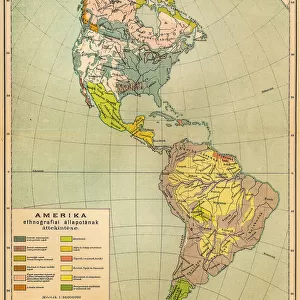
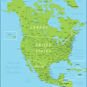
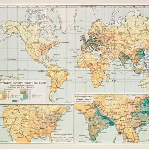
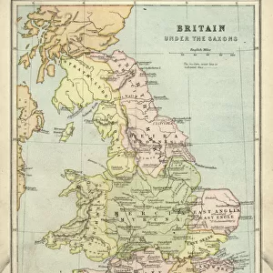
Physical map of North America 1895

![]()
Wall Art and Photo Gifts from Fine Art Storehouse
Physical map of North America 1895
The Rand-McNally Grammar School Geography 1895 - Chicago & New York
Unleash your creativity and transform your space into a visual masterpiece!
THEPALMER
Media ID 14824621
© This content is subject to copyright
Canada Caribbean Mexico North America United States
FEATURES IN THESE COLLECTIONS
> Arts
> Artists
> M
> Mexican School Mexican School
> Fine Art Storehouse
> Map
> Historical Maps
> Fine Art Storehouse
> Map
> USA Maps
> Maps and Charts
> Related Images
> North America
> Canada
> Maps
> North America
> Canada
> Related Images
> North America
> Mexico
> Related Images
> North America
> Related Images
> North America
> United States of America
> Maps
> North America
> United States of America
> New Mexico
> Related Images
> North America
> United States of America
> New York
> New York
> Maps
EDITORS COMMENTS
This print titled "Physical map of North America 1895" takes us on a journey back in time to the late 19th century. The map, sourced from "The Rand-McNally Grammar School Geography 1895 - Chicago & New York" offers a fascinating glimpse into the geographical landscape of this vast continent. With intricate details and vibrant colors, the map showcases not only the United States but also Canada, Mexico, and the Caribbean islands. It serves as a visual testament to the rich diversity and natural wonders that define North America. As we study this historical artifact, we are transported to an era when cartography was both an art form and a scientific endeavor. The meticulous craftsmanship evident in every line and contour reminds us of the dedication and precision required to create such masterpieces before modern technology took over. "The Physical Map of North America 1895" by THEPALMER is more than just a decorative piece; it is an educational tool that sparks curiosity about our shared past. Whether displayed in classrooms or homes, it invites viewers to explore forgotten territories, marvel at mountain ranges and rivers long since altered by time's passage. Through this artwork, we can appreciate how much has changed while acknowledging what remains constant – our collective fascination with maps as gateways into untold stories waiting to be discovered anew.
MADE IN THE USA
Safe Shipping with 30 Day Money Back Guarantee
FREE PERSONALISATION*
We are proud to offer a range of customisation features including Personalised Captions, Color Filters and Picture Zoom Tools
SECURE PAYMENTS
We happily accept a wide range of payment options so you can pay for the things you need in the way that is most convenient for you
* Options may vary by product and licensing agreement. Zoomed Pictures can be adjusted in the Cart.