Home > Maps and Charts > Related Images
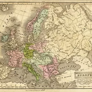
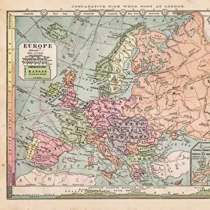
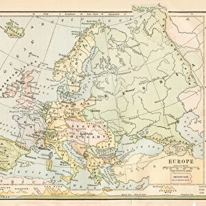
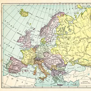
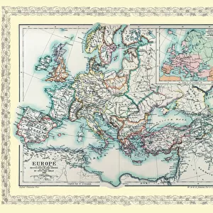
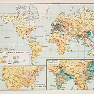
Map of Europe 1893

![]()
Wall Art and Photo Gifts from Fine Art Storehouse
Map of Europe 1893
New Pocket Atlas / Rand, McNally & Co -1893
Unleash your creativity and transform your space into a visual masterpiece!
THEPALMER
Media ID 15133650
© This content is subject to copyright
FEATURES IN THESE COLLECTIONS
> Fine Art Storehouse
> Map
> Historical Maps
> Maps and Charts
> Related Images
EDITORS COMMENTS
In this print titled "Map of Europe 1893" we are transported back in time to the late 19th century, a period marked by great political and cultural transformations across the continent. This meticulously detailed map, part of the New Pocket Atlas by Rand, McNally & Co. , offers us a glimpse into an era when cartography was both an art form and a crucial tool for understanding the world. The intricate lines and delicate shading on this vintage map draw our attention to every corner of Europe, revealing its diverse landscapes, borders, and cities as they existed over a century ago. It is fascinating to observe how national boundaries have shifted since then, reminding us of historical events that shaped modern-day Europe. As we examine this piece closely, we can't help but appreciate THEPALMER's skillful capture of the map's texture and colors. The aged paper adds character to the image while evoking nostalgia for a time long gone. The subtle sepia tones transport us further into history as if peering through a window into another era. Whether you are an avid historian or simply intrigued by old-world charm, "Map of Europe 1893" invites you on an exploration through time. Its presence on display will undoubtedly spark conversations about European history and geography while serving as a reminder that even in today's digital age, there is still something enchanting about holding tangible pieces of our past in our hands.
MADE IN THE USA
Safe Shipping with 30 Day Money Back Guarantee
FREE PERSONALISATION*
We are proud to offer a range of customisation features including Personalised Captions, Color Filters and Picture Zoom Tools
SECURE PAYMENTS
We happily accept a wide range of payment options so you can pay for the things you need in the way that is most convenient for you
* Options may vary by product and licensing agreement. Zoomed Pictures can be adjusted in the Cart.