Home > Europe > United Kingdom > England > Kent > New Hythe
Antique Map of the Cinque Ports, (French: Five Ports) - 19th Century
 - 19th Century")
![]()
Wall Art and Photo Gifts from Fine Art Storehouse
Antique Map of the Cinque Ports, (French: Five Ports) - 19th Century
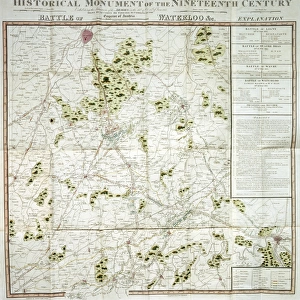
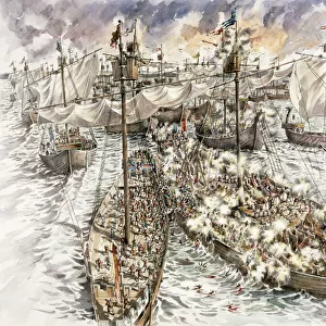
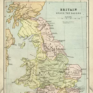
Cinque Ports, (French: Five Ports) medieval confederation of English Channel ports in southeastern England, formed to furnish ships and men for the king's service. To the original five ports—Sandwich, Dover, Hythe, New Romney, and Hastings—were later added the “ancient towns” of Winchelsea and Rye with the privileges of “head ports.” More than 30 other towns in the counties of Kent and Sussex were also attached. Until the 14th century the Cinque Ports provided the permanent nucleus of the royal fleet
Unleash your creativity and transform your space into a visual masterpiece!
powerofforever
Media ID 32210305
FEATURES IN THESE COLLECTIONS
> Animals
> Birds
> Columbiformes
> Doves
> Related Images
> Arts
> Art Movements
> Medieval Art
> Europe
> United Kingdom
> England
> Kent
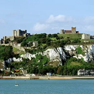
> Dover
> Europe
> United Kingdom
> England
> Kent
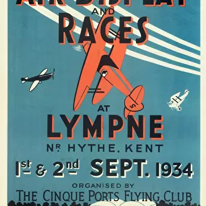
> Hythe
> Europe
> United Kingdom
> England
> Kent
> New Hythe
> Europe
> United Kingdom
> England
> Kent
> New Romney
> Europe
> United Kingdom
> England
> Kent
> Related Images
> Europe
> United Kingdom
> England
> Kent
> Sandwich
> Europe
> United Kingdom
> England
> Maps
EDITORS COMMENTS
This 19th-century print showcases an antique map of the Cinque Ports, a medieval confederation of English Channel ports in southeastern England. The Cinque Ports were established to provide ships and men for the king's service, and this map beautifully depicts their strategic locations. The original five ports - Sandwich, Dover, Hythe, New Romney, and Hastings - are prominently featured on the map. Over time, two additional towns - Winchelsea and Rye - were added with the privileges of "head ports" while more than 30 other towns in Kent and Sussex became attached to this confederation. As we delve into history through this print by powerofforever from Fine Art Storehouse, we can imagine how these bustling coastal towns played a vital role in shaping England's maritime strength. The Cinque Ports served as the permanent nucleus of the royal fleet until the 14th century. With its intricate details and elegant design, this antique map transports us back to a time when these ports were teeming with activity; ships setting sail for distant lands or returning laden with treasures. It reminds us of the rich historical tapestry that has shaped our present-day world. Whether you're an avid historian or simply appreciate fine art prints like this one by powerofforever from Fine Art Storehouse, let it serve as a reminder of our fascinating past and ignite your imagination about what life was like during those vibrant medieval times.
MADE IN THE USA
Safe Shipping with 30 Day Money Back Guarantee
FREE PERSONALISATION*
We are proud to offer a range of customisation features including Personalised Captions, Color Filters and Picture Zoom Tools
SECURE PAYMENTS
We happily accept a wide range of payment options so you can pay for the things you need in the way that is most convenient for you
* Options may vary by product and licensing agreement. Zoomed Pictures can be adjusted in the Cart.