Home > Africa > Central African Republic > Maps
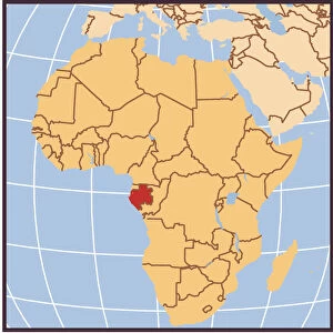
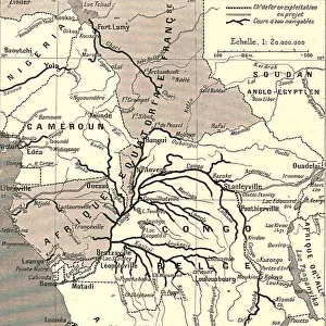
Equatorial Guinea map 1895

![]()
Wall Art and Photo Gifts from Fine Art Storehouse
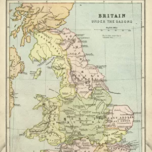
Equatorial Guinea map 1895
Meyers Konversations-Lexikon. Ein Nachschlagewerk des allgemeinen Wissens, 5th edition 17 volumes Bibliographisches Institut - Leipzig 1895-1897
Unleash your creativity and transform your space into a visual masterpiece!
THEPALMER
Media ID 13611771
© This content is subject to copyright
Atlas Mythological Figure Central Africa Guinea Morocco Paper Sahara Desert World Map Equatorial Guinea Republic Of The Congo
FEATURES IN THESE COLLECTIONS
> Africa
> Central African Republic
> Maps
> Africa
> Central African Republic
> Related Images
> Africa
> Equatorial Guinea
> Maps
> Africa
> Equatorial Guinea
> Related Images
> Africa
> Guinea
> Related Images
> Africa
> Morocco
> Related Images
> Africa
> Related Images
> Africa
> Republic of the Congo
> Maps
> Fine Art Storehouse
> The Magical World of Illustration
> Palmer Illustrated Collection
> Fine Art Storehouse
> Map
> Historical Maps
> Fine Art Storehouse
> Map
> USA Maps
> Fine Art Storehouse
> Travel Imagery
> Travel Destinations
> Morocco, North Africa
> Fine Art Storehouse
> Ultimate Earth Prints
> Amazing Deserts
EDITORS COMMENTS
This print showcases an exquisite antique map of Equatorial Guinea from the year 1895. Taken from the renowned Meyers Konversations-Lexikon, a comprehensive encyclopedia of general knowledge, this piece is a true treasure for history enthusiasts and cartography aficionados alike. The map depicts Equatorial Guinea in its early years, offering a glimpse into the country's geographical features during that period. With intricate details engraved onto paper, this illustration captures the essence of old-world charm and craftsmanship. The horizontal layout allows viewers to immerse themselves in the rich tapestry of Africa's diverse landscapes. As we explore this vintage masterpiece, our eyes are drawn to neighboring countries such as Republic of Congo, Morocco, and Guinea. Beyond these borders lies Central Africa and the vast Sahara Desert – symbols of untamed beauty and mystery. This engraving not only serves as a testament to physical geography but also acts as a portal through time. The artist behind this remarkable work remains unknown; however, their dedication to precision and artistry shines through every line on this historic map. It serves as a reminder that cartography is not merely about navigation but also an art form that tells stories about our world's past. "The Equatorial Guinea Map 1895" by THEPALMER transports us back to an era when exploration was at its peak and curiosity knew no bounds. Its presence on any wall would undoubtedly spark conversations about history, culture, and the timeless allure of antique maps.
MADE IN THE USA
Safe Shipping with 30 Day Money Back Guarantee
FREE PERSONALISATION*
We are proud to offer a range of customisation features including Personalised Captions, Color Filters and Picture Zoom Tools
SECURE PAYMENTS
We happily accept a wide range of payment options so you can pay for the things you need in the way that is most convenient for you
* Options may vary by product and licensing agreement. Zoomed Pictures can be adjusted in the Cart.